

Protect the link, not only the patch: secure existing habitat continuity, remove or modify barriers like fences and culverts so animals can cross safely, and start low-cost monitoring with a trail camera while you line up cooperative agreements with neighbors. Those three moves, done in that order, do more for wildlife movement than any amount of new planting.
TL;DR:
- Maintaining habitat continuity, removing barriers, and low-cost monitoring are more effective than planting for wildlife movement.
- Corridors are most used when they are natural, wide enough, and include buffers, with large mammals needing at least 100 meters in width.
- Proper crossing structures and fencing guide animals safely, with overpasses for large species and culverts for smaller ones, spaced according to species range.
- Ongoing maintenance, community involvement, and working with neighbors greatly increase corridor success and longevity.
- Natural corridors outperform engineered ones, and active stewardship combined with habitat layering can double a corridor’s functional width.
Table of Contents
- Why Wildlife Corridors Matter for Animal Movement
- Design and Placement: Alignment, Width, and Buffers
- Crossing Structures and Fencing That Direct Animals Safely
- Restoring Habitat and Vegetation Inside the Corridor
- Monitoring That Actually Tells You Something
- Working With Neighbors on Funding and Continuity
- Common Corridor Mistakes and How to Fix Them
- How Fencing Choices Support or Sabotage Corridor Function
- Legal and Policy Support for Corridor Protection
- Getting the Community Involved Beyond the Fence Line
- What Successful Wildlife Corridor Projects Have in Common
- Building Corridors Into Farms, Ranches, and Growing Towns
- What I’ve Learned Watching Corridor Projects Succeed and Fail
- How Fencefast Supports Corridor Projects on Working Land
- Sources
- FAQ
Why Wildlife Corridors Matter for Animal Movement
Conservation biologists split connectivity into two types. Structural connectivity is the physical presence of habitat linking two patches, like a wooded strip between two forest blocks. Functional connectivity is whether animals actually use that link, which depends on width, cover, and how much noise or lighting bleeds into it. A hedgerow can look connected on a map and still fail to move a single fox if it is too narrow or too exposed.
The evidence for corridors working is strong. A meta-analytic review of corridor effectiveness found that corridors increase movement between habitat patches significantly compared with unconnected patches. That single figure explains most of the enthusiasm behind wildlife movement strategies today.
Corridors support outcomes that go beyond animals simply passing through:
- Gene flow between otherwise isolated populations, reducing inbreeding risk
- Climate adaptation, letting species shift range as conditions change
- Fewer vehicle collisions where corridors route animals away from roads
- Access to seasonal food and water for wide-ranging species like elk and bear
Design and Placement: Alignment, Width, and Buffers
Start with what already exists. The same corridor effectiveness review found that natural corridors, features that existed before any human intervention, see more animal movement than corridors built from scratch. If you have a riparian strip, hedgerow, or ridgeline already running through your property, protecting it costs far less than engineering a new one.
Width matters more than most landowners expect:
- Large mammals (deer, elk, cougar) generally need at least 100 meters of usable width to feel safe moving through.
- Medium-bodied species (foxes, raccoons, smaller ungulates) can function with corridors closer to 50 meters.
- Amphibians and invertebrates can get by on 10 to 20 meters, provided the strip includes microhabitat features like logs or damp leaf litter.
- Add a buffer of 20 to 50 feet on each side wherever you can. Buffers absorb noise, light, and agricultural runoff that would otherwise degrade the core corridor.
If your property cannot support full width edge to edge, do not abandon the idea. Stepping stones, small patches of habitat spaced across the landscape, let animals cross in stages. Prioritize pinch points first: the narrowest, most constrained sections where a small investment removes the biggest bottleneck.
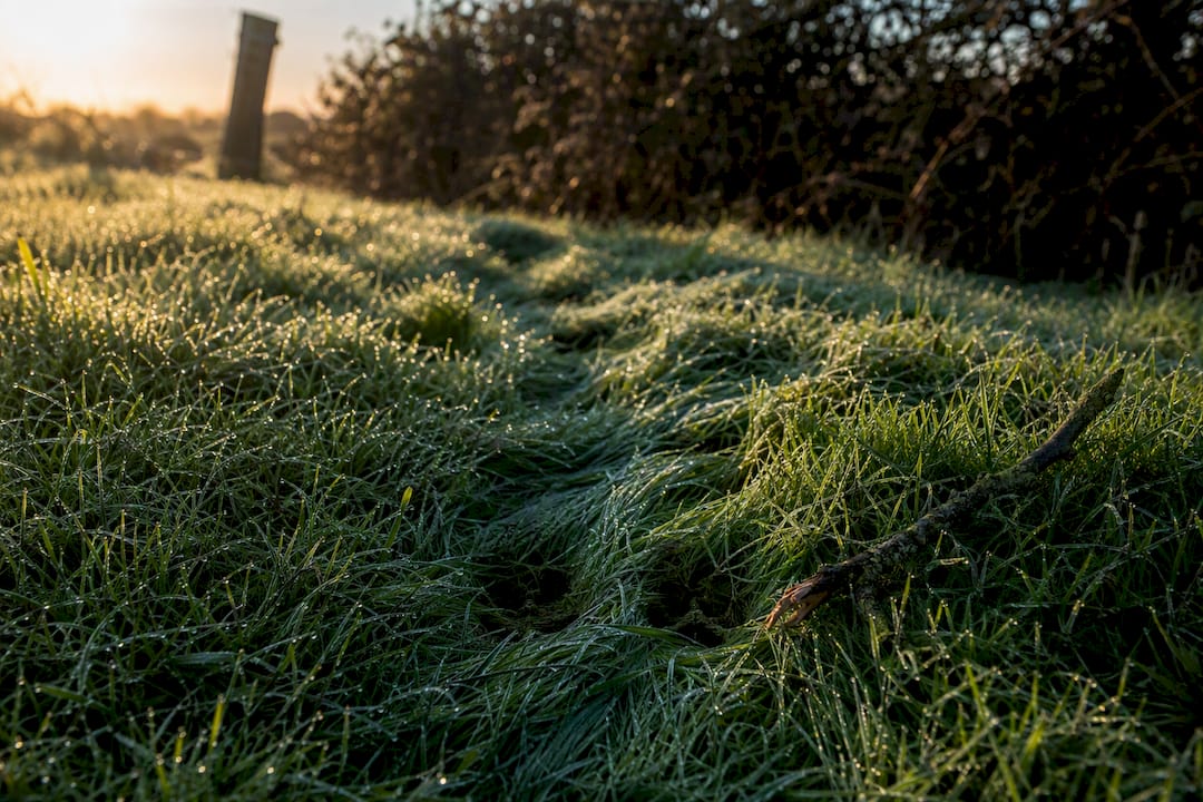
Pro Tip: Walk your property boundary at dawn or dusk before you plan anything. Tracks in mud or dew-flattened grass will tell you more about where animals already want to cross than any satellite map.
Crossing Structures and Fencing That Direct Animals Safely
Match the crossing to the species. Overpasses work for large ungulates and carnivores that avoid confined spaces. Underpasses and culverts suit smaller mammals and amphibians that prefer cover. Best-practice guidance from the Convention on Biological Diversity recommends installing more than one structure type wherever budgets allow, since a single design rarely serves every species using a corridor.
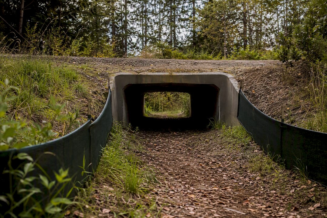
Spacing follows established transportation engineering standards. FHWA technical guidance recommends overpasses or bridges for large ungulates and carnivores no more than 1.5 kilometers apart to maintain real connectivity. Small-mammal culverts should appear at intervals in the range of hundreds of meters where home ranges are tight. Federal transportation data tied to sites like Snoqualmie Pass document large drops in wildlife-vehicle collisions once crossings were paired with fencing, not built alone.
That pairing is the part landowners most often get backward. Fencing near a corridor should:
- Funnel animals toward the crossing point, never seal off the corridor entirely
- Angle inward at approach zones so animals are guided, not trapped
- Include one-way escape ramps or gaps for animals that end up on the wrong side
- Get checked seasonally for washouts, gaps, or vegetation blocking the approach
A fence built to keep livestock in can double as a tool that keeps wildlife moving, if it is designed with a gap or crossing built into the plan from day one. Wildlife-friendly fencing options built for Canadian conditions show how this works without compromising livestock containment.
Restoring Habitat and Vegetation Inside the Corridor
Layer your plantings the way a healthy forest edge layers itself: canopy trees, then understory trees, then shrubs, then ground cover. Skipping straight to canopy trees leaves years of bare ground that erodes and offers no cover. Use locally native species; a nursery-grown shrub that did not evolve alongside your local deer and pollinators will not support the same food web.
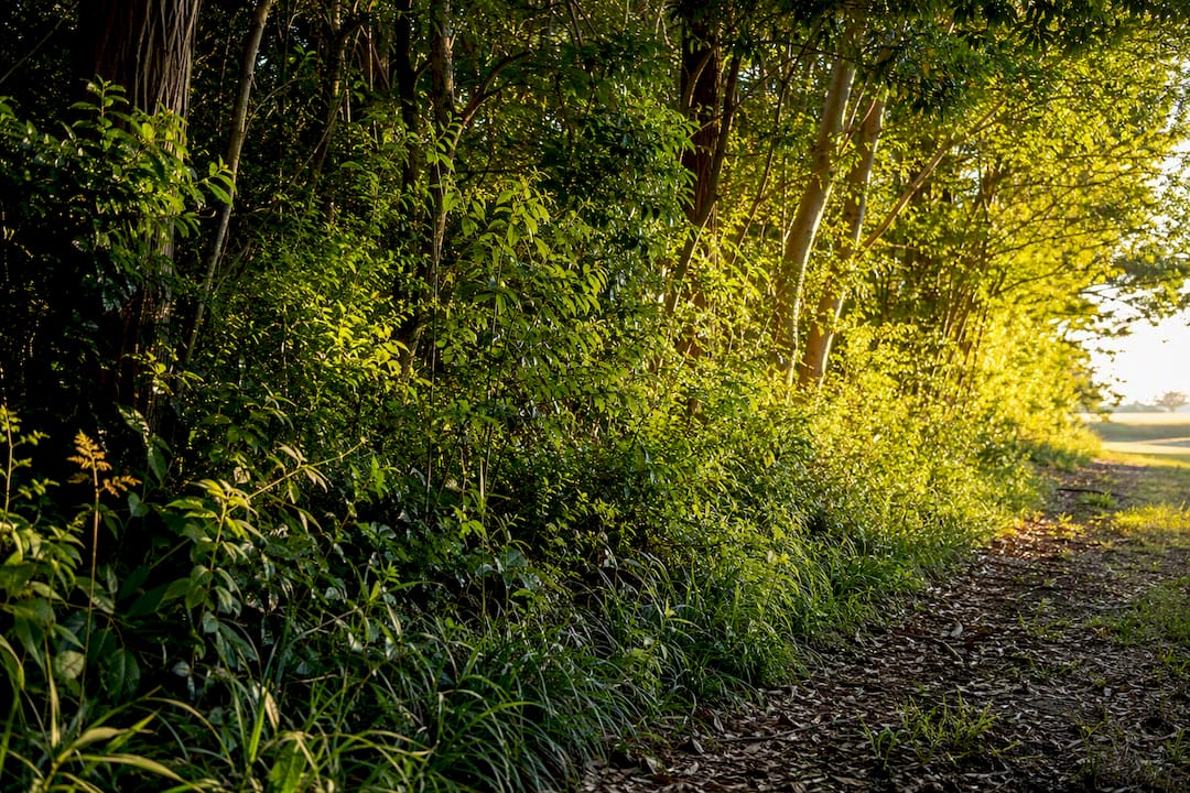
Early-successional species (fast-growing natives like willow, dogwood, or elderberry depending on your region) establish ground cover within a season or two. Once that cover holds, add slower structural species like oak or hickory for long-term resilience.
Small features punch above their weight:
- Brush piles give small mammals and reptiles immediate cover
- Rock piles create thermal refuges for reptiles and amphibians
- Even a small seasonal water feature draws in species that would otherwise skip the corridor
- Ongoing invasive plant control keeps aggressive species from choking out the layered structure you just planted
The practical planting steps outlined for landowners cover this sequencing in more detail if you are starting from bare pasture.
Monitoring That Actually Tells You Something
You do not need a research grant to know whether your corridor works. A practical starting protocol used by conservation projects: one trail camera roughly every 500 meters, checked on a simple, repeatable schedule.
- Set a baseline in year one: how many detections per week, and which species.
- Track crossing counts and seasonal presence or absence against that baseline every year for the first two years, then shift to biennial checks once numbers stabilize.
- Supplement camera data with eDNA sampling or targeted surveys if you want confirmation on amphibians or fish using a riparian corridor.
- Set an adaptive trigger: if detections drop below baseline for two consecutive seasons, stop and investigate. That drop usually means something changed, a blocked culvert, new fencing next door, invasive overgrowth, and it needs a fix before the corridor degrades further.
Pro Tip: Label your camera photos by pinch point, not just by date. When you review a year of data, you want to know instantly which specific 50 meters of corridor is underperforming.
Working With Neighbors on Funding and Continuity
A corridor that stops at your fence line is only half a corridor. Most wildlife movement strategies fail not because one property owner did the work wrong, but because the corridor breaks at the property next door.
- Voluntary conservation easements can lock in continuity across multiple owners without anyone giving up land ownership.
- A simple memo of understanding with a neighbor, even a handshake agreement backed by a shared calendar, keeps maintenance from falling through the cracks.
- Government cost-share programs and regional biodiversity grants often cover a meaningful share of fencing, planting, or culvert modification costs. Reach out to your regional agriculture or wildlife agency early, since early integration into planning is far more cost-effective than retrofitting later.
- Draft a one-page maintenance schedule and assign specific tasks (camera checks, fence repair, invasive removal) to specific partners so nothing depends on memory.
Common Corridor Mistakes and How to Fix Them
The most common failure is a corridor built too narrow to actually function. If land constraints make full width impossible, add stepping-stone patches rather than accepting a thin strip that no large mammal will use.
The second failure is designing for one charismatic species, deer, for instance, while ignoring the amphibians and small mammals that need entirely different width and cover. A tiered approach that plans for a large mammal, a dispersal-limited specialist, and a wide-ranging predator together tends to produce a corridor that works for far more species than a single-species design.
The third failure is neglect. A corridor with a blocked culvert or overgrown approach vegetation stops functioning just as surely as one that was never built. Walk it seasonally.
How Fencing Choices Support or Sabotage Corridor Function
Fencing decisions make or break corridor performance more than almost any other single factor on a working property. Wildlife-friendly fence designs, smooth top wires at the right height, gaps sized for the species you expect, angled approach sections, channel animals toward crossings instead of turning your property boundary into a wall.
- Temporary exclusion fencing lets you protect a restoration planting while it establishes, then comes down on a set schedule to restore full permeability once vegetation can handle traffic.
- Directional fencing designs funnel animals toward existing crossing points rather than forcing them to test every weak spot in a fence line.
- Virtual fencing, GPS-enabled collar systems that define a movable boundary without physical wire, lets you manage where livestock graze without a fixed structure blocking a corridor at all. That flexibility matters most during calving season or drought rotation, when livestock and wildlife pressure on the same land peak at the same time.
A land manager’s guide to wildlife corridors and fencing walks through how these fencing choices interact with corridor width and crossing placement on a real working property.
Legal and Policy Support for Corridor Protection
Corridor protection sits at the intersection of local zoning, regional conservation planning, and, in some jurisdictions, national wildlife policy, and the rules differ sharply depending on where your property sits. At the local level, many counties and municipalities maintain overlay zones or conservation subdivision ordinances that restrict development along mapped wildlife corridors or riparian buffers. Check your local planning department before you assume a corridor on your land carries no formal protection.
Regional and state or provincial agencies often run the programs that matter most to a working landowner: habitat connectivity grants, technical assistance for crossing design, and sometimes tax incentives tied to conservation easements. These programs vary by jurisdiction, so what is available in one state or province may not exist in the next.
National frameworks tend to set broader direction rather than regulate individual parcels directly. In the United States, transportation-linked connectivity work has gained momentum through federal highway policy, which increasingly treats wildlife crossings as standard infrastructure rather than an optional add-on. A Congressional Research Service report on wildlife corridors documents how federal funding streams have started prioritizing connectivity planning earlier in infrastructure projects, which lowers costs and improves outcomes compared with retrofitting crossings after a road is already built.
None of these frameworks require a private landowner to do anything specific on their own property in most cases. What they do provide is funding, technical support, and sometimes legal protection for corridors that cross public and private land together. The practical move is contacting your state or provincial wildlife agency directly rather than assuming your property automatically falls under, or is exempt from, any particular rule.
Getting the Community Involved Beyond the Fence Line
Corridor protection works better when it is not just one landowner’s project. Public awareness campaigns run by regional land trusts or wildlife agencies help neighboring landowners understand why a corridor running through several properties matters, and that understanding often turns into voluntary participation once someone sees a camera-trap photo of a cougar crossing their neighbor’s pasture.
Citizen science programs give non-landowners a real role too. Community members can log wildlife sightings, road-kill locations, or trail-camera photos through apps and databases run by regional conservation groups, building a dataset far larger than any single property owner could collect alone. That data helps identify which pinch points across a whole landscape need attention first, information that is nearly impossible to gather from one parcel in isolation.
Local schools and nature centers sometimes run corridor-focused education programs, walking students through why a hedgerow matters or how to read animal tracks. These programs build long-term public support for the easements and zoning protections that keep corridors intact decades after the original landowner has moved on.
If you are managing a corridor that crosses into public land or connects to a larger regional network, reaching out to the organization coordinating that network is worth the effort. Regional wildlife corridor coalitions often already have mapping data, funding contacts, and monitoring protocols in place. Plugging into an existing effort saves you from building all the citizen science and outreach machinery from scratch.
What Successful Wildlife Corridor Projects Have in Common
The strongest corridor projects share a few traits regardless of location or target species. They protect existing natural features rather than building corridors entirely from bare ground, consistent with the finding that natural corridors see more use than manipulated ones. They pair crossing structures with fencing rather than installing either alone. And they treat monitoring as part of the build, not an afterthought added once something seems off.
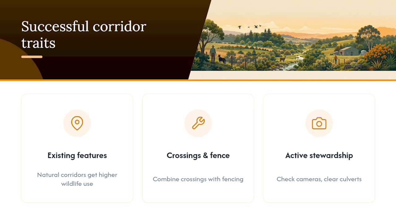
One consistent pattern across successful projects: improving the quality of the land surrounding a corridor, shifting adjacent pasture to lower-intensity grazing or agroforestry, can effectively double a corridor’s functional width without buying or converting a single additional acre. That means a landowner with a modest, narrow corridor is not stuck. Changing how the surrounding 20 or 30 acres gets managed can make a 50-meter strip function like a much wider one.
Managed corridors with active stewardship, meaning someone actually checking cameras, clearing culverts, and adjusting plantings, show substantially higher wildlife use than corridors that were built and then left alone. The difference between a corridor that works and one that quietly fails over five years usually comes down to whether anyone kept showing up.
Small-property projects tend to succeed fastest when they focus on connecting to something bigger rather than trying to be a self-contained habitat. A quarter-mile hedgerow that links two forest blocks does more conservation work than a five-acre island planted in isolation.
Building Corridors Into Farms, Ranches, and Growing Towns
Agricultural landscapes and expanding rural towns present different challenges, but the same core principles apply. On working farms and ranches, the best corridors follow field edges, fence lines, and riparian strips that are already marginal for crop or forage production. Converting a strip that barely produces hay anyway costs far less, in both money and opportunity, than carving connectivity out of your best pasture.
Livestock management and corridor protection do not have to compete for the same acres if fencing and grazing rotation are planned together. Rotational grazing that keeps cattle off a riparian corridor during key wildlife movement windows, spring dispersal, fawning season, protects both the corridor and the forage quality of that strip for later grazing.
In growing rural towns and exurban development, corridors face pressure from a different direction: fragmentation from new roads, subdivisions, and fencing that was never designed with wildlife in mind. The fix starts before construction, not after. Integrating a mapped corridor into a subdivision’s site plan or a new road’s design costs a fraction of retrofitting a crossing once the road is paved and traffic patterns are set.
Where agricultural and residential development meet, working with neighbors on shared corridor segments matters more than on a single large property, since fragmented ownership means a corridor can be broken by any one of several owners deciding independently to fence it off. A simple approach that works across both settings: prioritize the corridor segments that connect to existing protected land first, since those connections deliver the most conservation value per dollar spent.
What I’ve Learned Watching Corridor Projects Succeed and Fail
The corridors that work are rarely the ones with the biggest budgets. They are the ones where someone kept checking the camera. Planting establishment takes two to three years before a strip looks like real habitat, but the stewardship, checking crossings, fixing fences, watching for invasive spread, never really ends. Start with one pinch point, collect real data, and let the results guide the next move.
— Juiced
How Fencefast Supports Corridor Projects on Working Land
There are practical sources for the physical side of corridor protection: fencing, tools, and virtual-fencing systems that turn a design plan into something built on the ground. Rather than treating wildlife fencing as a specialty afterthought, There are suppliers who stock directional and wildlife-friendly components alongside standard agricultural fencing used for livestock containment.
If you are modifying an existing fence line to funnel animals toward a crossing point, the fence equipment collection covers the structural components for that kind of retrofit. For the fasteners, staplers, and connectors needed to adjust a fence quickly, fence tools and fasteners fills that gap without a special order. And if your corridor plan involves managing livestock timing around a sensitive restoration area, Gallagher eShepherd virtual-fencing systems enable moving a herd boundary without using physical posts, which can be important during the years a new planting establishes. Landowners can seek design consultation or tailored equipment lists from suppliers, including guidance on grant programs that may offset the cost of virtual-fencing adoption.
Sources
- A meta-analytic review of corridor effectiveness
- Wildlife crossing structures — FHWA
- Best management practices for wildlife corridors — CBD
- Wildlife crossings — U.S. DOT / FHWA
FAQ
Do wildlife corridors actually work?
Yes. A meta-analysis of corridor studies found corridors increase animal movement between habitat patches by roughly 50% compared with unconnected patches, and natural corridors performed even better than built ones.
What are the core pillars of wildlife conservation?
Most conservation frameworks center on habitat protection, connectivity between habitats, population monitoring, threat reduction (including road mortality and fragmentation), legal and policy protection, community engagement, and adaptive management based on monitoring data.
What are effective ways to protect endangered animals?
The most effective approaches include protecting existing intact habitat, securing corridors between fragmented patches, installing wildlife-friendly fencing that directs rather than blocks movement, reducing road mortality through crossing structures, controlling invasive species, monitoring populations with tools like trail cameras, and supporting landowner incentive programs and legal protections that keep habitat from converting to other uses.
Can you give an example of a wildlife corridor?
A riparian strip connecting two forest blocks is a common example, and highway crossing systems combining overpasses, underpasses, and directional fencing, such as those documented in federal wildlife crossing projects, are a well-studied engineered version.
How wide does a wildlife corridor need to be?
It depends on the species: large mammals generally need at least 100 meters, medium species can function with around 50 meters, and amphibians or invertebrates can get by with 10 to 20 meters if microhabitat features are present.

